NICOBARS – Geography:
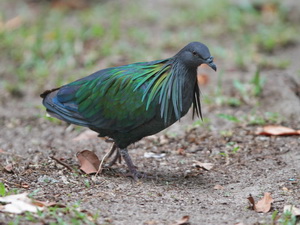
 GEOGRAPHY:
The Nicobar Islands are situated in the South-east of the Bay of Bengal between 6 degree – 10 degree N latitude and between 92 degree- 94 degree E longitude. There are altogether 22 large and small islands, out of which only twelve have inhabitants.
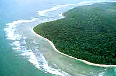
The most northerly island of the group is Car Nicobar, which is 143 miles from Port Blair and the ten degree channel about 75 miles separate in from Little Andaman. Chowra, Teressa, Bompoka, Katchal, Kamorta, Nancowry and Trinket form the central group of Nicobar islands ; while in the southern group are Pulo Milo, Little Nicobar, Kondul, Great Nicobar and so on. The extreme southern point of Great Nicobar, previously known as Pygmalion Point and now Indira Point, is about 91 geographical miles from Pulo Brass of Achin Head of Sumatra. The uninhabited islands in the central and southern group are Batti Malv, Tileangchong and Meroe , Trak, Treis, Menchal and Kabra respectively. The Nicobars stretch over 36 miles, with an aggregate of 635 sq. miles.
ORIGIN OF NAME :
Falling between the sea route from South India / Sri Lanka to South East Asia and vice-vers, the voyagers referred it as “land of the nake” i.e. Nakkavar which is perhaps the direct Predecessor of the current name “Nicobar’. The medieval Arabic name ‘Lankhabatus’ is a mere mistranscription and misapprehension of “Nankakar or Nakkavar”. Lord Ram, the hero of epic ‘Ramayana’ is meant to have passed through the Islands during his period of exile )Mathur: 1967). Somdev’s ‘Kathasaritsagar’ (11th century) indicates it as ‘Narikel Dweep’. The islands have also been mentioned in the accounts of travellers like Fahien, (6th century); I-T’sing (early 7th century); Ptolemy (2nd century); Marco Polo (13th century) and Friar Oderic (early 14th century). The islands were known in China as Lo-Jan Kuo (land of the naked people) according to the writings of I-T’Sing. An inscription dated (1059 AD) of the Chola King of Tanjore indicates that these islands were used as base shelter station for waging war and keeping control over South East Asia. The geographical names for the different islands have all obscure, complicated and interesting histories, whereas, each island has a native name too.
PHYSICAL CHARACTERISTICS :
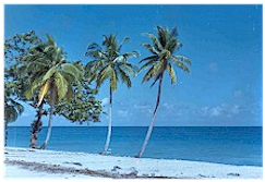
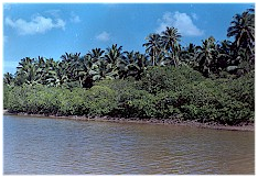
Car Nicobar is remarkably flat except for some cliffs in the north and small hilly areas in the interior. It is bordered by a silvery beach and areas of flat ground consisting of coraline diluvium.
Nancowry and Kamorta, have a hilly terrain covered with grass, forming undulating meadows. Empress Peak is about 1.420 ft. high and is the highest in Kamorta. The Nancowry harbour, with two entrances towards the east and west, is one of the finest and safest harbours in the world. Katchal is one of the largest islands in the central group. It is abut 61 sq. miles in area. It is slightly hilly in the centre but has a remarkable flat area, like Car Nicobar. Katchal has the most suitable soil for paddy cultivation. Trinket is another small flat island. It is located at the eastern entrance to Nancowry harbour. Chowra is almost flat, except for a hill which is located at its southern tip. Like Car Nicobar it has no safe berthing and the coral formation around the island is reported to be a great impediment to anchoring vessels.
Teressa and Bompoka are also hilly. The former has a considerable flat area, while the latter has a few flat spaces around the western coast. Tillangchong has hills of elevations above 1,000 ft.
Great Nicobar is the southernmost land mass of the Nicobar group of Islands. Most of this island is hilly and undulating. The main hill range runs from north to south. Mount Thullier which is about 2,105 ft high is the highest peak. Galathea, Alexandra and Dagmar are the major rivers. Kondul and Little Nicobar are also hilly and undulating.
As the Nicobars apparently lie directly in the local line of greatest weakness, severe earthquakes are to be expected, and have occurred many times. Stocks of great violence were recorded in 1847, 1881 (with tidal waves), and many times during 20th century. The tidal waves caused by the explosion of Krakatoa in the Straits of Sunda in 1883, were severely felt.
An earthquake epicenters off the west coast of Sumatra measuring 8.6 on the Richter scale caused a severe tsunami to strike parts of South-east Asia, India, Sri Lanka on 26th December 2004. Sea water inundated several coastal towns and villages taken over 250,000 human lives and affecting close to five million people.